Satellites
Geostationary Satellites: A Constant Presence in Earth's Orbit
Geostationary satellites occupy a special niche in the realm of space technology. Unlike their equivalents
that whiz around Earth in various orbits, geostationary satellites appear to hover motionless in the sky relative to a given position, maintaining a fixed position over a specific longitude on the equator. This unique characteristic makes them invaluable for a vast array of applications, ranging from telecommunications and weather monitoring to navigation and direct broadcast television.
The real magic behind a geostationary satellite's seemingly stationary stems from its mean orbital radius. It circles the Earth at an altitude of approximately 35,786 kilometers (22,236 miles) above the equator, on the equatorial plane. This specific distance and the angle that the orbit makes with the equatorial plane, known as the inclination - closer to zero - are crucial orbital parameters for achieving the ingenious feat. At this altitude, the satellite's orbital period exactly matches Earth's rotation period of 24 hours. That means, the satellite races around Earth at the same speed Earth spins beneath it, creating the illusion of it being stationary from a ground observer's perspective.
That means, if a satellite is launched from the United Kingdom for its use in communication, the former will remain above the skies of the country all the time for its uses.
Launching Satellites to Geostationary Orbits
Propelling a satellite into this precise orbit is a very technically challenging process; it requires careful planning, execution and of course, precision. In fact, launch sites are situated close to the equator to take advantage of Earth's rotational boost. The launch vehicle, then, injects the satellite eastward, matching the direction of Earth's rotation, further contributing to achieving the desired geostationary velocity.
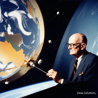
By the 1960s, the idea of use of geostationary satellites gained traction. In 1963, Syncom 2, a geosynchronous satellite developed by Hughes Aircraft, became the first to achieve a stable geostationary orbit. This marked a crucial milestone. Two years later, Early Bird, the first commercial communications satellite, was launched. This event ushered in a new era of global connectivity.
Applications of Geostationary Satellites
With the unique vantage point of geostationary satellites, a multitude of applications make use of them:
-
Telecommunications: Geostationary satellites serve as vital relays for communication signals, enabling long-distance phone calls, satellite internet access, and data transmission across continents. Their constant presence allows for fixed antennas on Earth to maintain a connection, simplifying communication infrastructure.
-
Weather Monitoring: Geostationary satellites equip meteorologists with a powerful tool for observing weather patterns. They continuously capture images of Earth's atmosphere, providing valuable data on cloud cover, precipitation, and storm development - a crucial combination for weather forecasts and issuing timely, severe weather warnings.
-
Navigation: Certain geostationary satellites play a vital role in the Global Positioning System (GPS) constellation. These satellites transmit precise timing signals to the GPS receivers on Earth that utilize them to determine their location.
-
Direct Broadcast Television: Geostationary satellites are instrumental in delivering television signals directly to homes with satellite dishes. The constant position of the satellite allows for fixed dish orientation, enabling uninterrupted reception of television programming. For instance, Sky TV in the UK uses the Astra 2 satellite fleet; This fleet consists of multiple satellites positioned at a specific location called the 28.2° East geostationary orbit. This position allows the satellites to appear stationary in the sky from the perspective of viewers in the UK, enabling a fixed dish to receive the signal. Just look at the direction of satellites in a long street of a town in the UK, you will see them being installed facing the same direction!
-
Military Applications: The military also make use of geostationary satellites for secure communication, navigation, and surveillance purposes. Their ability to maintain a fixed view of a particular region makes them valuable assets for military operations.
Challenges
- Limited Number of Orbital Slots: The geostationary orbit is not an infinite resource. Satellites must be spaced carefully to avoid signal interference. As the number of satellites increases, so does the challenge of maintaining adequate spacing.
- Signal Degradation: Transmission signals from geostationary satellites weaken as they travel to Earth through a relatively long distance, 36000 km, requiring high-gain antennas for reception. This can be a disadvantage in areas with poor infrastructure or for mobile applications.
- Vulnerability to Space Debris: The geostationary orbit is a prime location for satellites, making it more susceptible to collisions with ever growing threat of space debris. Collisions can damage or destroy satellites, posing a significant risk.
Clarke's Belt
Long before we scrolled through social media feeds on our phones or enjoyed uninterrupted satellite TV,
science fiction writer Arthur C. Clarke, who chose to live his life in Sri Lanka, the island off South India, envisioned a world connected through orbiting relays.
In 1945, at the age of 28, Clarke published a prescient article in "Wireless World" titled "Extra-Terrestrial Relays."
Here, he proposed a revolutionary idea: using satellites in a specific orbit – now known as geosynchronous – to revolutionize global
communication.
Clarke's concept wasn't entirely born out of thin air, though. Scientists had been exploring the use of radio waves for
long-distance communication since the 1920s, and World War II spurred advancements in radar technology.
However, the Earth's curvature limited the reach of radio signals. Clarke's stroke of genius was realizing that a satellite
positioned at a specific altitude, roughly 22,236 miles or 35577 km above the equator, could match the Earth's rotation.
This would allow the satellite to appear stationary from a ground perspective, perpetually hovering over a single point.
In honour of the great visionary who paved the way for the communication by satellites, the famous - now, crowded - geostationary orbit is also called, Clarke's Belt.
Mr Clarke came to the island nation after the Second World War due to one of his other passions, apart from scanning the heavens - scuba diving. He, however, fell in love with Sri Lanka and
received honorary citizenship in Sri Lanka and lived the rest of his life as a honoured guest until his death.
Although Clarke's vision wasn't met with immediate enthusiasm when he first expressed the concept, the seed, undoubtedly, was sown. The concept resonated with some scientists and engineers, particularly as the space race gained momentum. The impetus came from an unexpected quarters: the 1957 launch of Sputnik 1 - just 58cm in diameter - the first artificial satellite launched by the then Soviet Union, marked a turning point. The success of this mission fueled discussions about the practical application of satellites.
Clarke's foresight wasn't limited to just communication. He also envisioned the use of these satellites for weather monitoring and television broadcasting. Today, geosynchronous satellites play a vital role in our daily lives. They enable a wide range of services, from global navigation systems (GPS) to satellite internet and uninterrupted telecommunication.
Arthur C. Clarke's contribution extends beyond the technical aspects. He ignited public imagination with his visionary ideas, inspiring future generations of scientists, engineers, and even science fiction writers. His story serves as a testament to the power of imagination and the transformative potential of science fiction. From the pages of "Wireless World" to the vast expanse of space, Clarke's vision for geosynchronous satellites continues to shape our interconnected world.
Food for thought:
If you walk along a long street in the UK, you will see Sky satellite dishes facing the same direction. How do you account for it?

Polar Satellites: Unveiling Earth from Pole to Pole
While geostationary satellites stay majestically above us in a fixed position, polar satellites paint a different picture. These dynamic observers traverse Earth in a nearly north-south path, encircling the planet multiple times a day and offering a comprehensive view from pole to pole. This unique orbit equips them to gather a wealth of data vital for scientific research, environmental monitoring, and resource exploration, making a round trip in about 80-90 minutes.
Unlike their geostationary counterparts, polar satellites travel in a near-polar orbit. Their inclination, the angle between their orbital plane and the equator, is typically high, ranging from 80 to 90 degrees. This inclination allows them to pass over the Earth's polar regions, providing a complete view of the planet with each revolution. Their altitude varies depending on the mission, typically ranging from 200 to 1,000 kilometers (124 to 621 miles) above Earth's surface.
The Benefits of a Dynamic Perspective
The roaming nature of polar satellites unlocks a bonanza of information:
- Earth Observation: Polar satellites carry a diverse array of instruments, including high-resolution cameras, spectrometers, and radar systems. These instruments capture detailed imagery of Earth's surface, enabling us to monitor changes in glaciers, forests, and land cover. They also play a crucial role in mapping Earth's topography and resources.
- Weather Forecasting: By observing cloud formations, atmospheric temperature, and water vapor content, polar satellites provide valuable data for weather forecasting models. This information is crucial for predicting weather patterns, severe weather events, and climate change.
- Environmental Monitoring: Polar satellites are instrumental in monitoring environmental changes like ozone depletion, deforestation, and pollution levels. Their global coverage allows scientists to track environmental trends and assess the health of our planet.
- Disaster Management: The rapid imaging capabilities of polar satellites enable near real-time monitoring of natural disasters like floods, wildfires, and volcanic eruptions. This information helps emergency response teams react quickly and effectively.
- Oceanography: Polar satellites equipped with radar altimeters can measure ocean surface topography with high precision. This data allows scientists to study ocean currents, sea level rise, and marine ecosystems.
Challenges
While polar satellites offer a wealth of benefits, certain limitations inevitably exist:
- Limited Coverage at Any Given Time: Unlike geostationary satellites that provide continuous observation of a specific region, polar satellites only capture data as they fly overhead. This necessitates multiple satellite passes for complete coverage.
- Data Transmission Challenges: The high-resolution data collected by polar satellites requires significant bandwidth for transmission. This can be a challenge, especially for satellites in lower orbits.
- Short Revisit Times: Due to their lower altitude and faster orbital speed, polar satellites cover the same ground more frequently than geostationary satellites. However, this also translates to shorter revisit times for specific locations, requiring a constellation of satellites for comprehensive monitoring.
In conclusion, polar satellites, with their dynamic orbits and comprehensive view of Earth, are vital tools for scientific discovery and environmental monitoring. Their ability to capture high-resolution data from pole to pole empowers us to understand our planet better, predict weather patterns, manage resources, and respond to environmental challenges. As technology advances, polar satellites will continue to be at the forefront of Earth observation, providing invaluable insights for a sustainable future.
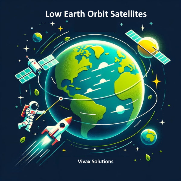
Low Earth Orbit Satellites - LEO Satellites
Low Earth orbit (LEO) satellites reside in the closest ring around Earth, zipping around the planet at breakneck speeds. Unlike their geostationary counterparts that appear fixed in the sky, LEO satellites are constantly on the move, completing a full orbit in a mere 90 minutes. This frenetic pace brings them closer to Earth's surface, offering unique advantages and applications in various fields.
The domain of LEO satellites lies between 160 kilometers (100 miles) and 2,000 kilometers (1,200 miles) above Earth. This proximity offers several advantages:
- Reduced Launch Costs: Reaching LEO requires less energy compared to higher orbits, translating to lower launch costs for satellites. This makes LEO an attractive option for deploying large constellations of satellites for various applications.
- High-Resolution Data: The closer proximity to Earth allows LEO satellites to capture imagery and collect data with exceptional detail. This is particularly beneficial for applications like Earth observation, remote sensing, and high-speed internet access.
- Lower Latency: Due to the shorter distance between the satellite and Earth, communication signals travel faster with LEO satellites, resulting in lower latency. This is crucial for real-time applications like GPS navigation and financial transactions.
A Multitude of Missions
LEO satellites find application in a diverse range of endeavors:
- Earth Observation: The high-resolution imagery captured by LEO satellites is valuable for monitoring agricultural land, tracking deforestation, and assessing environmental changes. They also play a role in disaster management, providing real-time data on floods, fires, and other emergencies.
- Global Navigation Systems (GNSS): Constellations of LEO satellites form the backbone of GNSS systems like GPS and GLONASS. These systems provide precise positioning and navigation services for various applications, including commercial transportation, scientific research, and consumer electronics.
- Remote Sensing:LEO satellites equipped with specialized sensors can gather data on Earth's resources, including minerals, water availability, and soil composition. This information is crucial for resource exploration, sustainable development, and environmental monitoring..
- Internet Connectivity: LEO constellations are revolutionizing internet access, particularly in remote or underserved areas. By providing high-speed, low-latency internet connectivity, these satellites bridge the digital divide and empower communities with better communication and information access.
- Scientific Research: LEO satellites carrying scientific instruments can study the Earth's atmosphere, ionosphere, and magnetosphere. They also play a role in astronomy, observing celestial objects with greater clarity due to their position above most of Earth's atmosphere.
Challenges
Despite their numerous advantages, LEO satellites face certain challenges:
- Short Lifespan: Due to atmospheric drag at lower altitudes, LEO satellites have shorter lifespans compared to satellites in higher orbits. This necessitates regular replacement of satellites within a constellation.
- Signal Tracking: The rapid movement of LEO satellites across the sky requires sophisticated tracking mechanisms for ground stations to maintain communication.
- Potential for Congestion:With the increasing number of LEO satellite launches, there's a growing concern about orbital congestion. Careful planning and international cooperation are necessary to ensure safe and sustainable use of this valuable orbital space.
In conclusion, LEO satellites, with their agility and proximity to Earth, are transforming various sectors. From enabling real-time communication to providing high-resolution Earth observation data, LEO constellations are shaping the future of technology and fostering a deeper understanding of our planet. As advancements in technology address challenges like orbital congestion, LEO satellites are poised to play an even greater role in shaping a more connected and informed world.